News
Fire departments called out to fire
Scott Wagar
09/18/2012

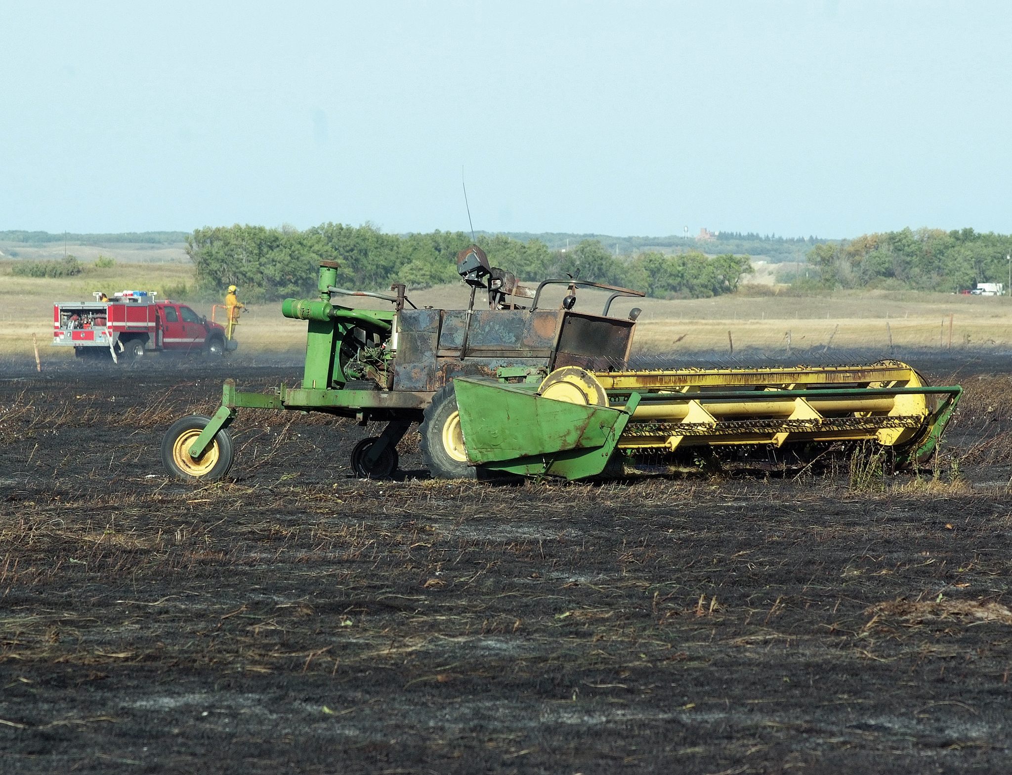
A dangerous field fire occurred just outside of Dunseith Wednesday afternoon, which burned hundreds of acres of land and traveled so quickly across the prairie that six additional fire departments from Rolette and Bottineau counties were called to the scene to assist.
“A property owner was haying and his hay conditioner malfunctioned and caught fire,” said Rick Gottbreht, Dunseith’s fire chief. “And that is what started the fire.”
There were high winds Wednesday afternoon, and with the local area so dry, once the fired started the flames burned with speed across the prairie, destroying 298 acres of land owned by several different individuals.
With the fire burning so rapidly from the start, Dunseith Fire Department made calls to the fire departments in Bottineau, Rolette, Rolla, Belcourt, Mylo and the Bureau of Indian Affairs Fire Department to assist them with the fire.
“There were 22 fire trucks at the scene, which included trucks from every fire station in Rolette County,” Gottbreht said. “All the trucks were needed. The fire was so intense it jumped two high grade roads like nothing. When it got going, there was no stopping it.”
The Bottineau Fire Department, who had just returned from a combine fire in the Gardena area, sent three trucks and six firemen over to Dunseith who assisted.
Besides fire trucks, ambulance crews were sent to the scene along with utility companies just in case their services were needed.
The fire went out due to an unexpected phenomenon, which the firemen were not expecting.
“It is kind of amazing how it stopped. It jumped into an alfalfa field that was so green and it wouldn’t burn,” Gottbreht said. “If it wasn’t for the alfalfa crop, the fire probably would have gone all the way to Highway 3 before it would have stopped.”
Since Wednesday, the Dunseith Fire Department was called back out to the fields due to start-ups from the original fire.
“Right now we have a total of 320 acres that have been destroyed by the fire,” Gottbreht said. “We actually can GPS the acres burned by going along side it. The BIA Forestry has the equipment and does it for us. They go to Google maps and put the boundary on the map and it tells us the acreage.”
The National Weather Service is currently warning individuals to be careful when it comes to fires due to the dry conditions. Individuals, who have any questions about fire conditions, should get in contact with their local fire departments, or go to the National Weather Service website at http://www.crh.noaa.gov/bis/fire.php.
